So we pulled into town Saturday afternoon in time for a short run and a bit of a scout of the higher reaches in and around Squaw Valley. I jogged out to the Five Lakes trailhead, and then climbed about 1,000 feet up to the snow line. The running was 100% clear up to about 7,200' after which the trail disappeared under a heavy blanket of snow, which was still a good two feet deep in places.


The creeks were running pretty good, so this stuff is definitely on the way out, but there is no doubt in my mind that there will be significant stretches of snow to negotiate if the course is not re-routed. Basically, the north-facing slopes and heavily forested areas above 7,000' are still covered, which means that much of the early going next weekend will still be covered in places and definitely wet. No biggie really. I'm just hoping the course is not re-routed, as I'd really like to experience the route as it has traditionally been run.

Today was a completely different experience. Dana, Alistair, Ian Torrence and I drove down to Foresthill and checked out the driveable parts of the course and the aid areas, and then Ian and I ran the crucial 15-mile section from Foresthill down to the river. The weather was no hotter than 80 degrees, and it was pretty comfortable the whole way as far as heat was concerned. Current forecast for race day is not much hotter, so I think we might be dodging a bullet on that front. River looked good, so I'm betting that we'll be fording rather than sitting in boats, so that's good news too.

Anyway, I'll let the following video (which is long and unedited) do the rest of the talking:


Green up the front side is not so much running as it is climbing with a few steps of running thrown in every now and then. Typically I consider anything over 1,100' per mile to be borderline pointless for running, especially on trail. Green mountain up the front side fits that bill with 2,400' feet of climbing in just over two miles. However, the craziest thing about the Amphitheater route up Green is that the bulk of the 2,400' ascent is in the first mile, meaning the grades are beyond borderline stupid for running, and a powerhike is as good, if not better than a running cadence.

On this particular evening, we were greeted with slick rocks through the opening scramble due to the continuing rain, and then super slippery slush above, say, 7,000' where the trail became a little more reasonable and consistently runnable yet frustratingly slippery. To sum up, the conditions were terrible.

So anyway, we had a time trial going on ... in Boulder ... and the total number of Boulder residents that showed up? Zero. Apparently the Boulder folk don't play outside when it's wet.

In attendance, and awarded full man and woman points were: George Zack, Tim Waggoner (Lucho), Bob Sweeney, Brandon Fuller, Kerrie (?), myself, Eric Bergman, Pete Stevenson, Victoria Funk, Cat Speight, Alex Alvarez and a (very) late PittBrownie.

We had more than three people running together and we were ostensibly "trying to better each others' times," which according to the Boulder Open Space regulations constitutes a race. Somehow the rangers had caught wind of our gathering (from an anonymous email no less), and as I was unloading at Chautauqua from the drive down and chatting with George, a friendly ranger showed up and asked us if we had anything to do with a race that was going on.

"Race? No, just out for a run with a couple of friends."

The ranger of course new that we were lying through our teeth, but I don't think he had the heart to shut us down. He mumbled something about permits and then sheepishly headed back to his cabin. Soon thereafter, the group headed off in different directions to reconvene at the Gregory trailhead.

There had been some chatter about the route before we all got there. George was firmly in favor of taking the most direct route, while a few others - myself included - thought it might be nice to take the longer and mellower Ranger route so we could actually run. George was having none of it and, frustrated with the chatter, took off up the mountain with no notice. The run was on.

Lucho slipped in behind George - soon overtaking - and then I think it was Eric, myself and Bob. I tried to keep pace with Lucho through the opening few switchbacks, but soon gave up on that as I was clearly not firing particularly well. My breathing was super heavy and my thighs were on fire from all the big, immediate and unpredictable step-ups through the rocks. I just settled in and ran a comfortable pace. I say 'ran' but really it was no more than a token running cadence. At one point I did a shoulder check only to see Bob right behind me walking faster than I was running. I just gave up on running, trotting were possible, but basically hiked the lower section.

By the time we got to the snow and the more runnable stuff, Lucho was out of sight, Eric was being passed by Bob 10-20 seconds in front of me, and I was back to holding my own, although I still couldn't muster much of an effort. Eventually I started feeling a little more comfortable with the whole outing and my various system started operating at a comfortable level. I passed Eric with a few hundred feet of climbing to go, and then near the top started reeling in Bob, but it was too little too late.

Lucho was up in 32:xx, which given the conditions seems pretty fast to me. I got up a bit after Bob in a disappointing 36:02, followed by Eric - maybe a minute back - and Zack two back. I forget who was next, but I think it was Pete, Kerrie and Brandon. Easy going down via Ranger, then some Zack Rabbit IPAs in the parking lot, a little trash talking and we were on our way back home a little after 9:00.

So it turned out to be a fun evening, and we'll do it all over again in a few weeks in Fort Collins, well Loveland, on Round Mountain which is entirely runnable and a much more reasonable 3,000' over 4.7 miles.


Got out with my brother for a romp around East Kent this morning. We went from Canterbury to Grove Ferry along the Stour Valley Way, trampling across numerous farmers' fields, before cutting north for Reculver and the coast on the Saxon Shore Way.

A swan on the River Stour. The Stour runs through my home town of Canterbury.
A country house.

The Grove Ferry Inn. We cut north to the coast from here.
Pretty random.
We spent a lot of time route finding. Our first sight of the coast. Reculver towers in the distance.
By every church, there should be a watering hole.
Reculver towers. The ruins of an old Norman church sitting right on the coast.

From Reculver, we followed the coast to Herne Bay and then on to Whitstable before hooking into the Crab and Winkle Way, which is an old rail line that has been turned into a hiking trail between Whitstable and Canterbury.

Matt heading to Herne Bay.

Working the hill. Reculver towers in the background.
Beach huts and a wind farm out to sea. Herne Bay.
Funky signage on the Crab and Winkle.
Any cross-country route in the UK involves endless stile hopping.

Almost home. Outside Kent College, my old secondary school.

Canterbury to Herne Bay Pier was 16 miles, and then it was another six cold and breezy miles along the coast to Whitstable, followed by a further six back to Canterbury on the only section that I knew well. Total run was 28 miles in 4:15, with 20-25 minutes of that route finding and messing around. Great workout, and while I didn't feel like I needed to continue on and add any more miles I certainly felt like I could have. With 17 miles in the legs from the day before, this was a big confidence builder for Bandera.

The chalky Kentish mud sticks.
There is no finer post-run food.


Now working the second iteration of their Emergency Website, after a year of the original Emergency Website, the Saltwood Boxing Day Run (BDR) continues to be a study in how not to manage a running event, and yet it remains one of my favorite - if not favorite - races on the running calendar.

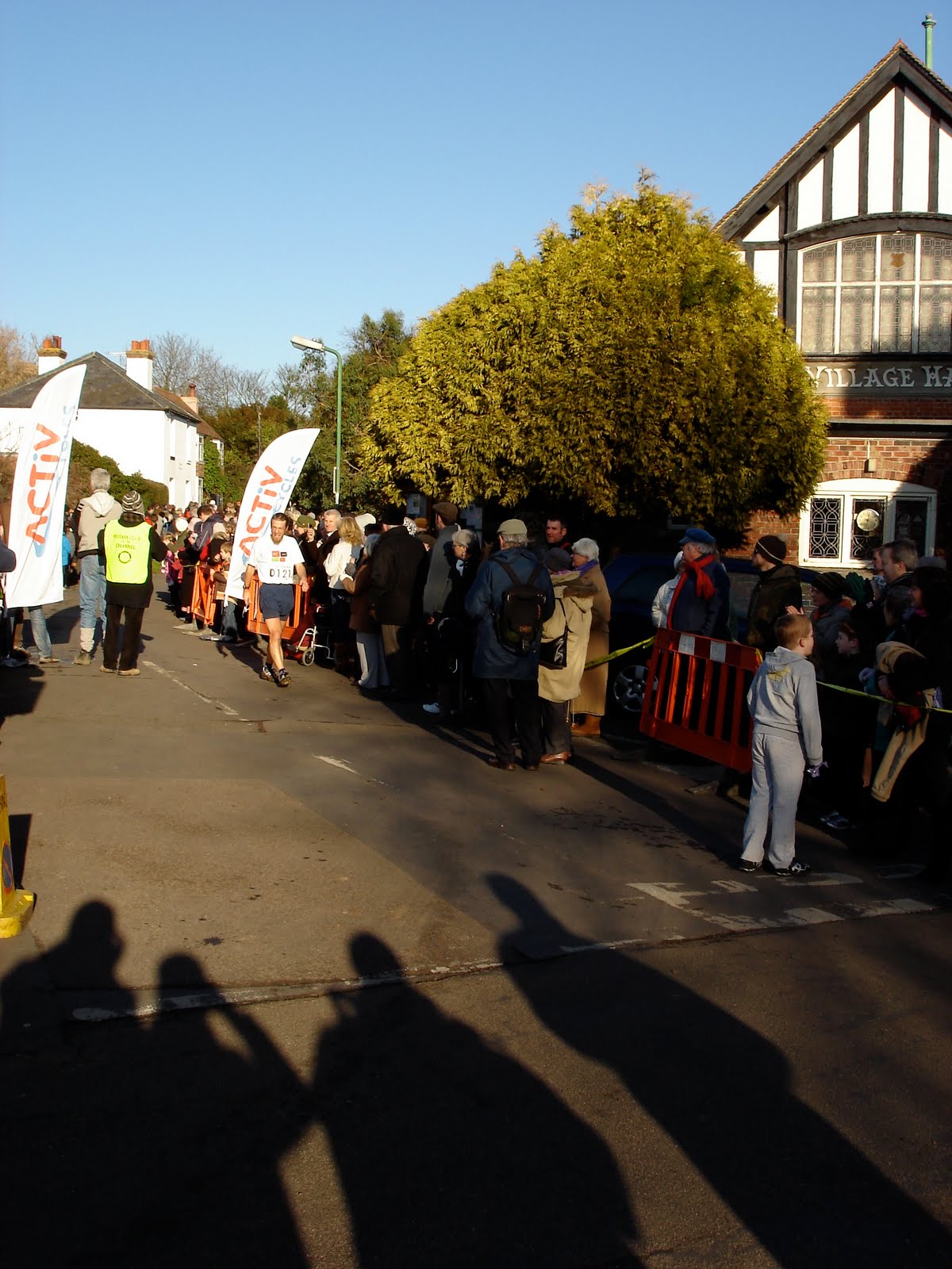
The race starts and finishes by the Saltwood village green, takes you on a three-mile spin around local farmland and woodland, and includes a number of steeplchase-like obstacles. Race HQ is the village pub, and it's four or five deep to get to the bar after the race. Love it!

2008 start.

The three years I have run the BDR, the timing has been something of a shambles and each year Stuart, the race director, seems to quite comically come up with new-fangled ways to mess up the results, stubbornly dismissing tried-and-tested methods of race timing.

In 2006, race organizers managed to list a majority of the 1,000+ finishers in the official results, but by no means all of them. They used the fairly orthodox finishing chute method, but rather than rip tabs from bibs, there was a guy with a ratty notebook at the end of the chute scribbling numbers as they walked past him. Needless to say, many numbers failed to make their way into the notebook and, by extension, the official results.

For the 2007 race, the organizers chose to do away with the ratty notebook, deciding instead to radio finisher numbers to Stuart in Nottingham (hundreds of miles away) as they crossed the finish line. This method was not a success, and apparently the back-up video of the finish line was a disaster too. The results were maybe 70% complete. And then there was last year: the bullhorn fiasco.

The finish line chute was done away with - why, I don't know - and race numbers were bullhorned to somebody somewhere (maybe Stuart in Nottingham) as finishers crossed the line. Inevitably, as the hordes started filing through, the bullhorn operator and scribe quickly became overwhelmed and only a scattershot of finishers were captured in the results - maybe a 50% success rate. Again, the back-up finish-line video was a failure.

I finished fifth last year, so my result was recorded before the system broke down.

Matt finished top 20, but his result was never recorded as the bullhorn system had begun its downward spiral!

And this year? Well, the newest results-capturing system has recently been expounded upon through the (second emergency) race website: "We are using bar codes this year! We didn't want to revert to a slow funnel, even though it has been the most reliable system in the past."

Brilliant!! Why revert to your most reliable system when you can try something completely new and hatstand instead? I can't wait to see how the bar-code system will work. Will there be a guy with a bar-code scanner scanning us as we cross the line, or will we be picked up and thrust across a grocery store checkout as we finish? I'm almost as excited to find out how this unique system will work as I am to get to Saltwood to toe the line for the fourth annual Clark and friends Boxing Day outing in the 35th running of the BDR.

At the end of the day, despite the fact that we all go out and run it as hard as we can, the race is not really about the race, it's about getting out with family and friends on bloated Xmas stomachs to romp around the great British countryside. In fact, the organizers, true to the history of the event, refuse to call it a race, referring to it simply as a 'run'.

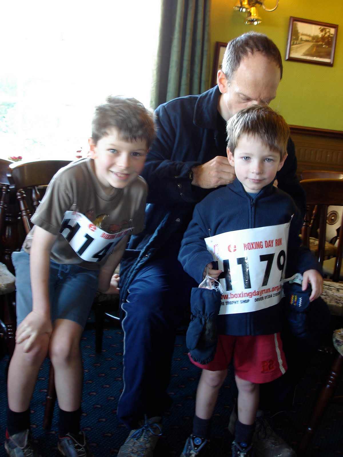
An aside on the registration procedure: You email Stuart your details and he emails you a Word doc attachment of your race number with instructions to print and "plasticize" it - the first year we received these instructions there was much discussion (and chortling) about how best to plasticize our numbers. Stuart then requests payment be put in the mail, relying on the honesty of the British public to follow through with ex post facto payment. I would imagine that the payment rate is about as successful as the various timing systems - patchy, at best.

Nephews William and Thomas in the pub with their plasticized numbers

No number for Alistair, so we went bandito. Race organizers were none the wiser.

If you ever find yourself in or around Kent on the day after Christmas, don't miss out on this gem!


Dan Turk put a message up on the Fort Collins Trail Runners listserv late last week about a planned run up Pikes Peak. The email came soon after I found out that I was in for the Pikes Ascent, so I quickly responded to Dan - a nine time Pikes vet - that I was up for the trip down to Manitou Springs, and we made plans for a 5am meet, with Alex May, another local Pikes runner making up our party of three. Alex and I were taking on the full climb and Dan was driving to the top for some quality time at altitude with a 3-2-1 workout (3 miles down to treeline, 3 back up, 2 miles back down, etc).

Having never run the Barr Trail, I was pretty intimated by the imposing sight of Pikes Peak as we made our way down I-25, but figured it would be just like any other big climb: stick your head down and settle in. Aside from knowing next to nothing about the trail, I had also never run a straight 8,000 feet of vertical in one shot (aside from Rainier, is that actually possible anywhere else in the US?), and certainly not up to and above 14,000 feet.

Anyway, Alex and I started out from the race start at the square in Manitou and jogged the mile and half to the trail proper. Once on the trail, I was gratified to find it in perfect running shape, with next to no technical issues to deal with. The opening climb through the 'W's is probably the steepest of the whole run, but because of the quality of the trail I was able to get into an easy but steady rhythm, passing No Name Creek at 45 minutes or so. I picked up the tempo a bit from here and pushed quite hard through the next section, which included some brief moments of down, and much easier grades in general. Went past Barr Camp in 1:18, and just kept plugging at the pace I had settled into, waiting for the fun at treeline to begin.

Hit the three-mile-to-go marker at 1:56, still feeling good with little noticeable impact from the rapidly decreasing supply of oxygen. Although the summit still looked impossibly far away, the sign said three miles, and I kept that in mind rather than spending too much time looking at the peak. By mile two to go, I was definitely beginning to feel the reduced oxygen, so slowed to maintain an equal effort. Went through in 2:12, for an almost 16-minute mile. Went through the penultimate mile in 14 minutes, and the final beast of a mile in 18:30 for a total run time of 2:44:03. I let out a yell - as I'm apt to do - as I rounded the final switchback onto the cog tracks, which was cause for a degree of amusement among some of the assembled tourists.

I ran every step of this climb with the exception of about 100 meters through the cruel section known as the 16 Golden Steps, which comes maybe a half mile from the top. The whole effort felt controlled, and served as a pretty big confidence boost with regards to running a sub 2:30 on race day - a number that will be borderline with respect to cracking the top 10.

Wore the Crosslites for this run and was for the most part happy with how they ran. There's no doubt they were responsive to the pea-sized gravel on the lower Barr Trail, but I'm still not 100% on them on the rocks. Either way, I'll probably run these at the race, although I need to test the Vasque Celerators a little more as they are a similar weight with a little more grip on the rock, I find. Maybe not as responsive as the Crosslites, however.

With a run at Flattop (12,300'), Hallet (12,700') and Taylor (13,150') planned for next weekend and then Longs the following weekend, I'm hoping that come race day I'll be able to push through some of the burn I felt at 13,000'+ today.


Since spreading the maps on my parents' dining room table, early in our visit, I had wanted to run to Deal from my parents' home in Canterbury via the North Downs Way. My first attempt didn't get out of bed due to jet lag. With a busy holiday schedule, New Year's Day was going to be the last and only chance to get it done.

Much of the North Downs Way has been used for centuries as a pilgrimage route to the shrine of Thomas Beckett at Canterbury Cathedral. It currently covers 153 miles west to east from Farnham, on the Surrey/Hampshire border, to the famed port town of Dover in Kent, via Canterbury. My route would cover 17/18 miles of the trail, with a detour to Deal.

True to form, I managed to lose the trail a couple of times even though I had a very detailed photocopied ordinance survey map of the route with me on the run.

The trail took me through Canterbury, past the Cathedral, to the picturesque village of Patrixbourne by way of a paved bike trail. Once in the village I made a premature left, which resulted in my first wrong turn of the day. After having run on tight country roads from the village for approximately 20 minutes, I was beginning to get that sneaking feeling I was heading in the wrong direction. After consulting the map at an intersection with named roads, I was able to confirm my fears and set about righting them by heading to Gypsy Cottage (a random house named on the map), where I would make a right to reconnect with the trail close to the busy A2 motorway.

Once back on the trail, I realised that I would have to step up the pace if I was going to come anywhere close to making my arranged rendez-vous with my dad, who had kindly agreed to meet me at Deal Pier at noon. Any more wrong turns, I surmised, would ensure a tardy finish to the run.

The trail took me across numerous farmers' fields, most of which made for tough going and heavy mud-laden shoes: not ideal conditions for moving efficiently and quickly. But they offered great views of the Kent countryside, while also offering rolling hills and glimpses of Kentish wildlife. I saw four or five red foxes, in addition to flocks of game birds. I also heard many farmers out hunting and saw evidence in the form of dead rabbits and game feathers. Having just eaten a delicious pheasant meal the night before I was envious of those bagging birds for the dining table.

The trail continued through more picturesque Kentish villages, with names and thatched roofs from an entirely different era: Womenswold , Wollage Village and Sheperdswell to name a few. I also passed Waldershare House, a megalithic stately home which was once apparently the seat of the Earl of Guilford. A quick Google search suggests it has since been cut up into apartments, a three-bedroom version of which is going for 450k (pounds).

A few miles past Waldershare House I reached the small village of Ashley, and after a time-check realised that I was going to have to take roads to Deal or risk being very late for my pick-up. Inexplicably I mistook Ashley for a different village when I consulted my map and headed off in entirely the wrong direction. It wasn't until I reached the A2 a mile or two later that I realised my mistake, which was confirmed when I stopped a lady to ask for directions to Deal. She laughed at me and told me to turn around and go back the way I had come. It was now a certainty that I would not make Deal Pier on time.

By the time I got to East Studdal, running past a pay phone, I made the decision to bag the run and call home to my mom to ask if she could call my dad and ask him to come pick me up. However, nobody was home and I realised that everyone had probably joined my dad in coming to pick me up. By this time it was about 12:20 and I had four and half miles to Deal, according to a road sign in the village. I put my head down and raced the roads on tired legs, finally reaching Deal Pier at 12:50. Thankfully, my cold family, including Dana and Alistair, were there waiting.

A fine start to the New Year. One of my goals for 2009 is to significantly reduce the number of times I get lost on the trail.